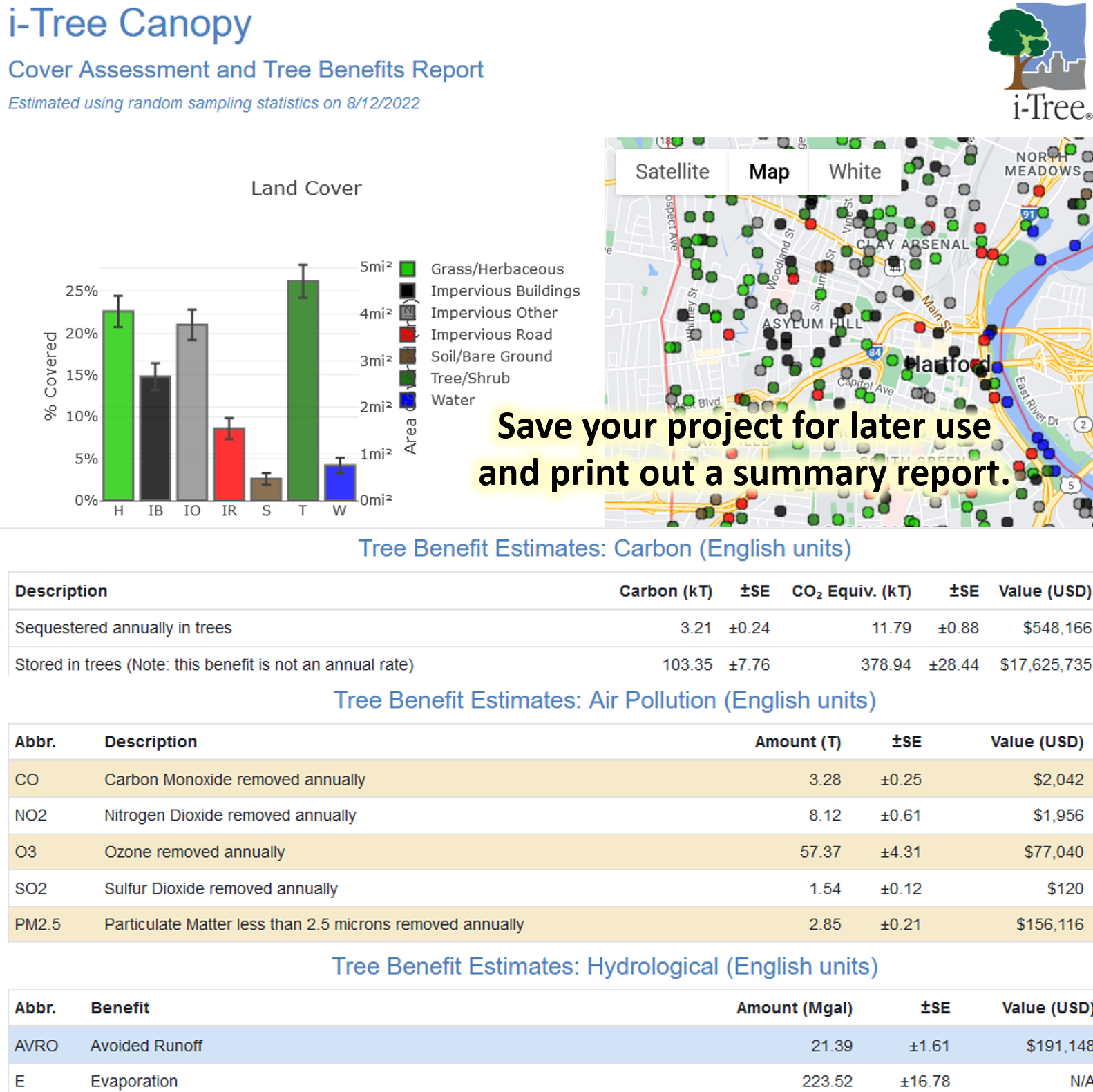
Use this tool to classify land and tree cover across a given area using random sampling of aerial imagery. See tree canopy benefits in terms of carbon dioxide, air pollution, and stormwater impacts.
How to use it:
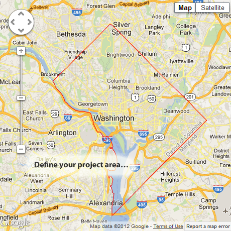
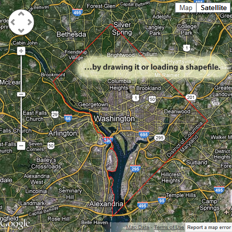
- Select from existing geographic boundaries, draw your own project area boundaries onto Google Maps, or load an ESRI shapefile.
- You can use multiple, non-overlapping boundaries at the same time.
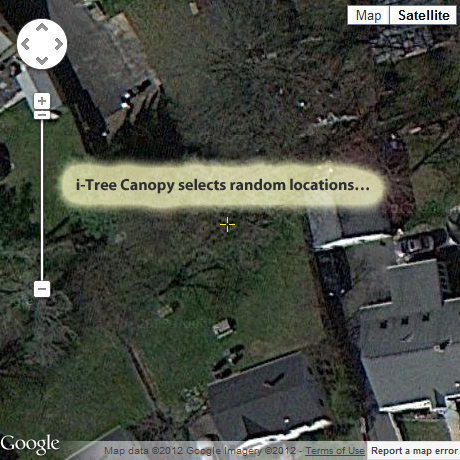
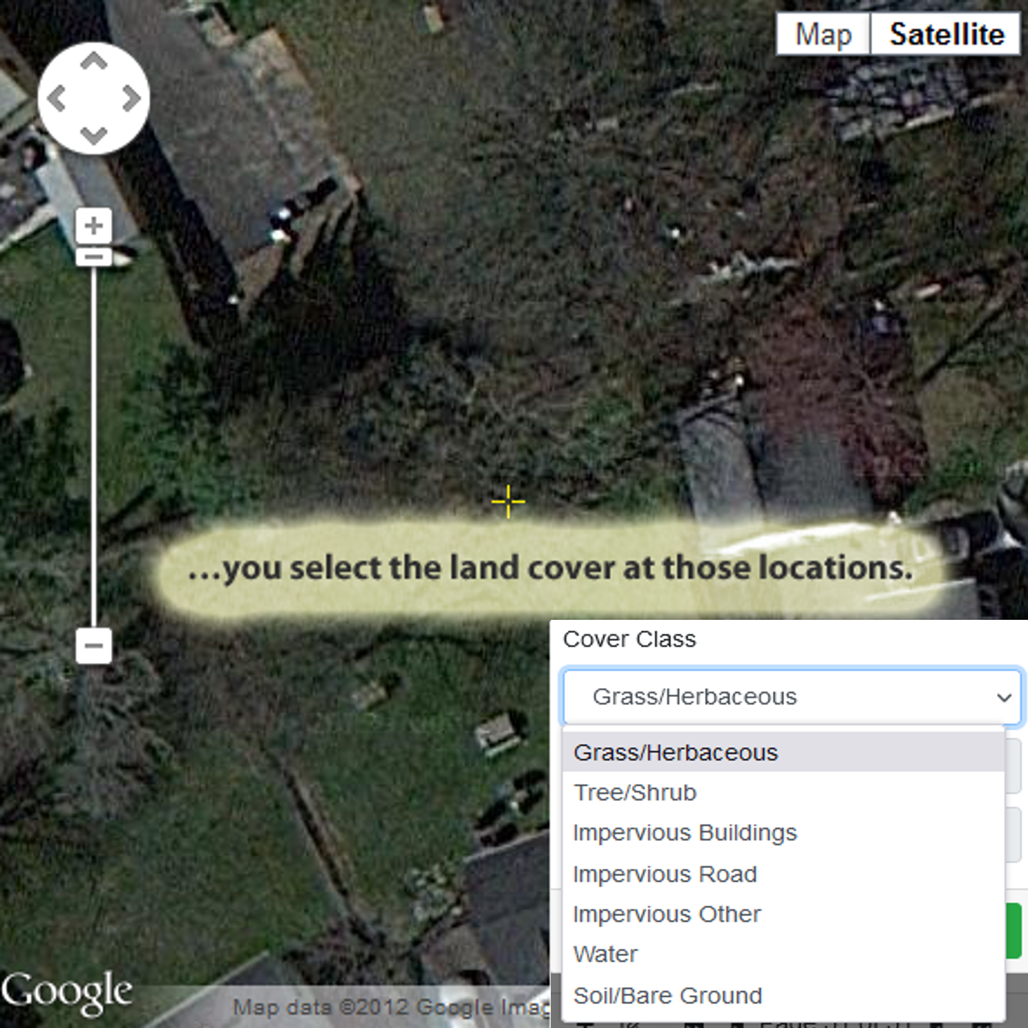
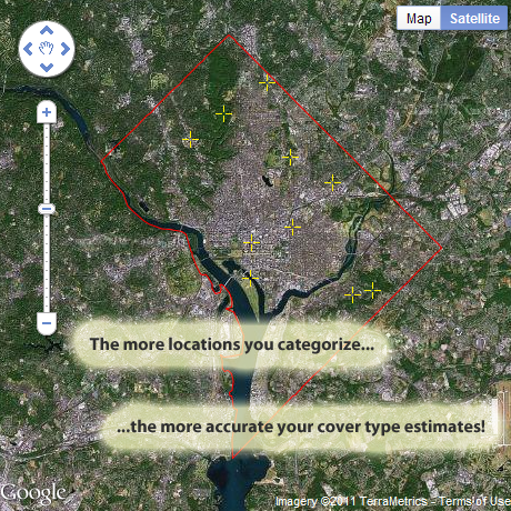
- i-Tree Canopy randomly generates sample points and zooms to each one so you can choose from your pre-defined list of cover types for that spot.
- With i-Tree Canopy, you review Google Maps aerial photography at random points to conduct a cover assessment within a defined project area.
- 500-1000 survey points are suggested; the more points you complete, the better your cover estimate for your study area.
- If estimating tree cover, tree benefits can also be estimated.
- Learn how i-Tree Canopy works.
- Video Learning Resources
- i-Tree® does not endorse any specific web-browser, but has been tested with modern versions of Chrome, Firefox, Edge, and Safari. Please use the Feedback form to report issues. i-Tree is a registered trademark.
- Warning: This tool can be very data intensive. It is not recommended for use on metered plans.
- If i-Tree is not yet supported in your region, contact us to explore opportunities for funding collaboration.